Here is a video entourage of the devastating Category 4 Hurricane Ian:
Check out the GIF post: From the Satellite…Category 4 Hurricane Ian on .GIPHY, Video + 2022 Season Info
Re-published from: Hurricane Ian – Landfall Over Florida

9/27 – 9/28/22 Image courtesy of NOAA/NESDIS/STAR

9/27 – 9/28/22 Image courtesy of NOAA/NESDIS/STAR
🌀 🌀 🌀 🌀 🌀 🌀 🌀 🌀
Re-published from: Category 4 Hurricane Ian – Has Moved Inland Over Florida

9/28/22 Image courtesy of NOAA/NESDIS/STAR

9/28/22 Image courtesy of NOAA/NESDIS/STAR
YouTube Video of radar of Hurricane Ian moving into Florida:
🌀 🌀 🌀 🌀 🌀 🌀 🌀 🌀
Re-published from: Category 4 Hurricane Ian – Has Moved Inland Over Florida
9/28 – 9/29/22 Image courtesy of NOAA/NESDIS/STAR

9/28 – 9/29/22 Image courtesy of NOAA/NESDIS/STAR
YouTube Video of radar of Hurricane Ian moving through the Florida mainland:

9/29 – 9/30/22 Image courtesy of NOAA/NESDIS/STAR

9/29 – 9/30/22 Image courtesy of NOAA/NESDIS/STAR

9/30 – 10/1/22 Image courtesy of NOAA/NESDIS/STAR

9/30 – 10/1/22 Image courtesy of NOAA/NESDIS/STAR
There is a need for resources for recovery. See the embedded Tweet below, and this will take you to the Versatileer post: “The Danger of Hurricanes & Tropical Activity – Summer & Fall Weather Series + Resources For Recovery”.
CATEGORY 4 HURRICANE IAN
🌀 🌀 🌀 🌀 🌀 🌀 🌀 🌀 🌀 🌀 🌀 🌀 🌀 🌀
See Tips: Preparedness Before, During & After Tropical Weather:
The Danger of Hurricanes & Tropical Activity – Summer & Fall Weather Series + Resources For Recovery https://t.co/ape7EquF9O
— Jerry Marquardt (@Versatileer) June 5, 2022
Click here if Twitter widget does not show
Be prepared, and be safe.
RESOURCES:
Versatileer Weather Page:

Tropical Activity & Wildfires Report, Tropical Systems-Atlantic & Pacific + wildfire forecasts:
![]()
Hurricane Preparedness Kit, courtesy of the Ward Law Group: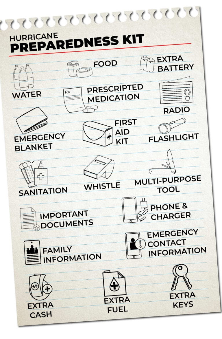
FIND YOUR LOCAL NOAA.com WEATHER RADIO STATION:
FIND YOUR LOCAL NATIONAL WEATHER SERVICE FORECAST:
STAY SAFE!!!
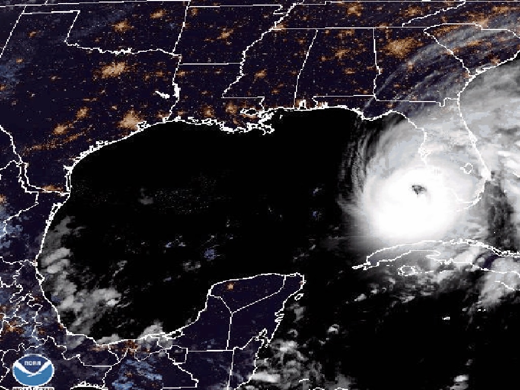
Image courtesy of NOAA/NESDIS/STAR
Widget not in any sidebars
More on Versatileer:
![Full 180° Rainbow in Oak Forest, Illinois.jpg]()
Full 180° Rainbow in Oak Forest, Illinois
10/12/2021![File:Gale pennant.png]()
Happy National Big Wind Day – 2025
04/12/2025![INSTA_MagicAndMedecine.png]()
Magic & Medicine by Olena Nikitin Cover Reveal – Release Date Coming October 2023
09/02/2023![two_epac_2d0__08_00_20220918.jpg]()
From the Satellite...Pacific Tropical Storm Madeline on .GIPHY, Video + 2022 Season Info
10/08/2022![a plate of chips, salsa, and guacamole on a table.jpg]()
Happy National Chip & Dip Day – 2024
03/23/2024


very interesting!